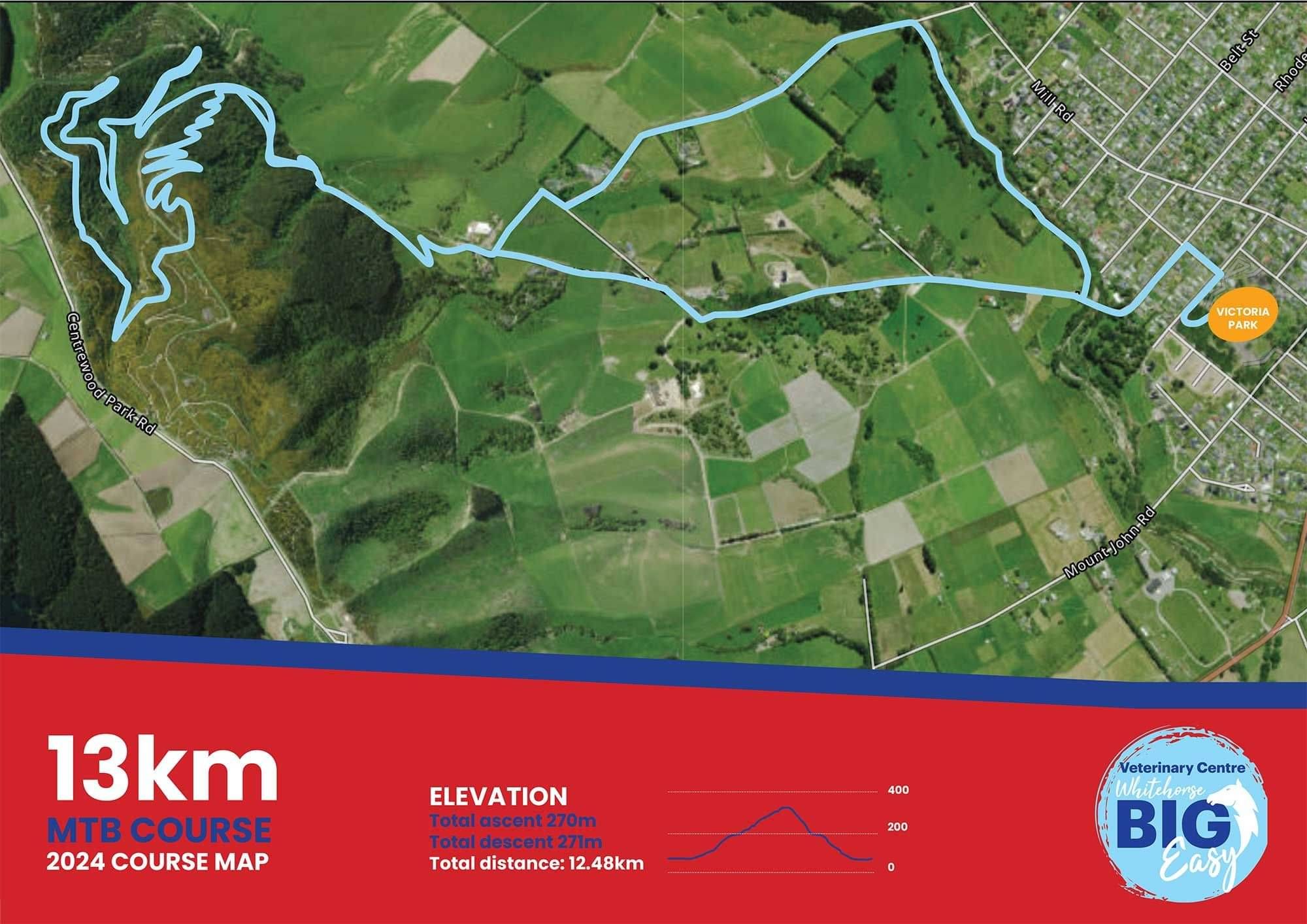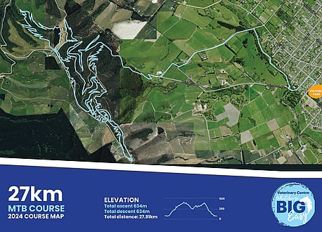
Course Maps
Plot your course!
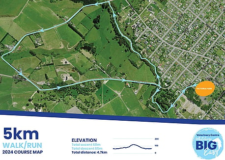
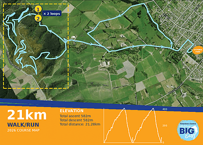
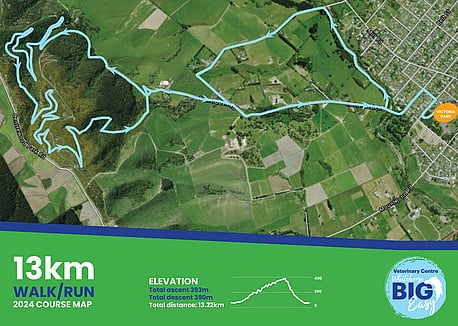
Run/walk- This year 21km run means half marathon so the challenge is up; this year we have a brand new course in place, taking in more of the Big Easy tracks. Get ready for a bit of hill work up (we'll post an altitude map soon!). All courses will be well marked along the way. The 13km run/walk makes its way up the Big Easy as well, before dropping down the exciting walking track. The 5km loop tracks around the scenic loop tracks in town (Garlands and Naylor's tracks), before hooping around near the top of Point Bush.
Mountain bike. The 27km and the 15km go up the Big Easy and include the Twisted Linker and end of the Twisted Monster trail. The 27Km makes it way up to the Whitehorse then back down Wriggly Beast, Rosewood Link & Filthy Animal and back onto the Big Easy. The 27 Km goes into private land where there is over 5km of digger-built mountain bike trails. A loop of the Big Gully is first and then another loop at the end of the airstrip paddock. These two loops include new trails as well as upgraded older trails. You will have the option of riding a variety of intermediate grade trail features or you can choose the B-Line and ride around them. The 27 Km also includes the Cheese Roll.
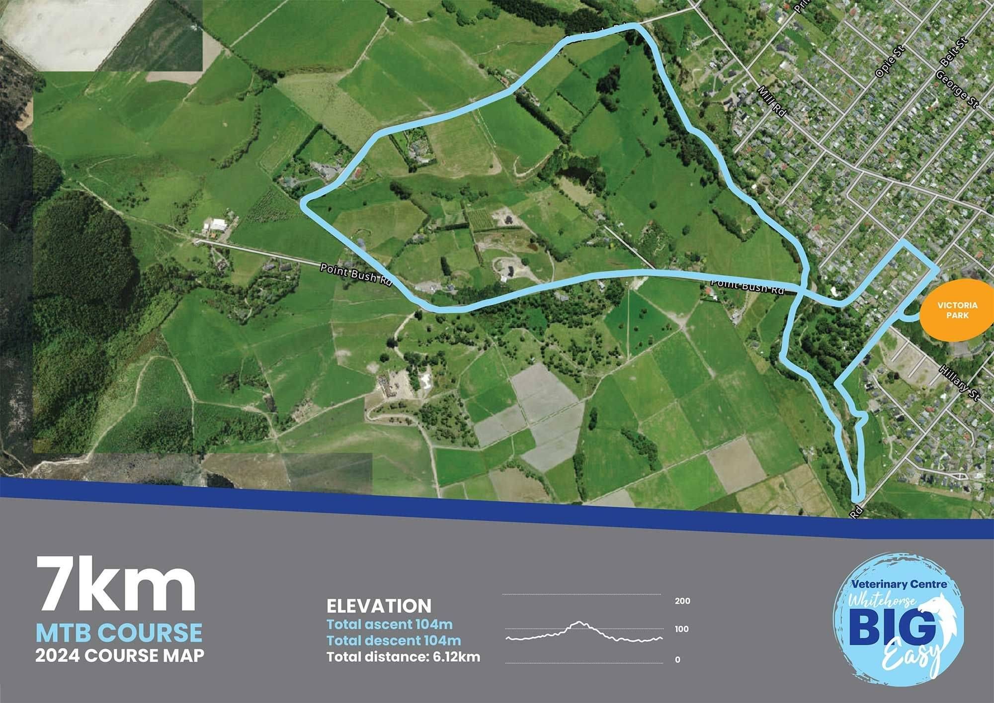
The 7km mountain bike course is set on the great courses in town, and near the showgrounds (over similar course as in 2024) starting and finishing at Victoria Park.
You can get out and train on the walk and run courses at anytime, they are all on public land. Some of the MTB courses are on private land, but there are plenty or tracks to train on up in the Hunters Hills. Check out Waimate's public tracks here